Measure distance and area#
Draw a path or a region to get its length or its size in real-world units, and keep the result as a layer.
Measurement answers how far and how big. You draw a path or an area on the map, and Geo Map reports the distance or the size in real-world units. It keeps the result as a layer that you can name, restyle, and export.
There are two measurements, and both sit together at the foot of the tool group in the tool palette: Measure distance, shortcut M, and Measure area.
Draw a measurement#
Both tools work the same way. Click to place each vertex, and the running result follows your cursor. Press Enter or double-click to finish. While you draw, Ctrl+Z or Cmd+Z removes the last vertex you placed. If you remove the only remaining vertex, Geo Map abandons the measurement. Escape cancels outright.
The map labels the result. If the label lands somewhere unhelpful, drag it clear of the shape.
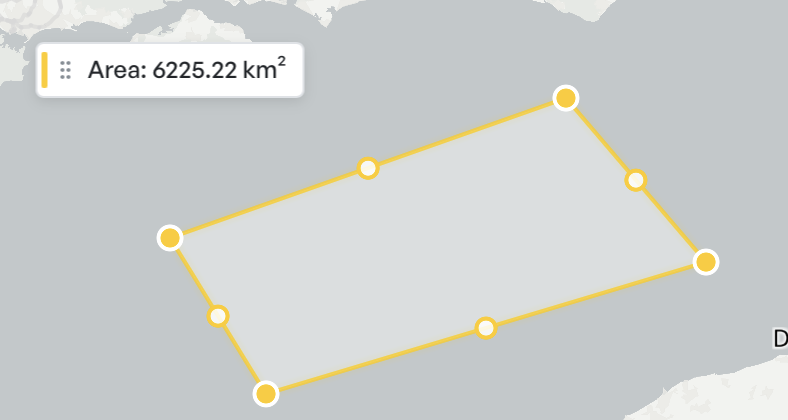
Read the length or area#
Select a measurement to fill the inspector. An area measurement reports Area, Perimeter, and Vertices. A distance measurement reports Length and Vertices, and adds a per-segment breakdown that lists each leg's length and bearing. Use the breakdown when a route matters leg by leg rather than end to end.
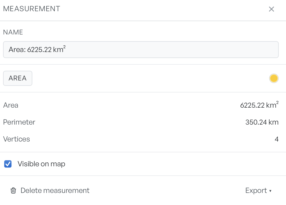
Units scale to the size of the thing you measure. Distances read in centimetres below a metre, metres below a kilometre, and kilometres above that. Areas read in square metres, then hectares, then square kilometres. Bearings read as three-digit compass degrees.
You can edit the Name field at the top, and it is the one place in the feature where you can rename a layer. Enter commits and Escape reverts. Geo Map rejects a blank name. Visible on map hides the measurement without a delete, and the colour swatch restyles it.
Rename, export, or remove one#
Right-click a measurement on the map for its own menu: Rename, Duplicate, Copy as GeoJSON, Delete, and Zoom to. Copy as GeoJSON puts the geometry on the clipboard, which is the quickest way to move a shape into another tool.
The inspector footer has Delete measurement and an Export menu. The menu offers GeoJSON, KML, and CSV for that single measurement. To export whole layers instead, see Exporting.