Read a feature's properties#
Select a shape to open its geometry and property tree, and choose between features that sit on top of each other.
Click a feature on the map and the inspector on the right fills with it: its geometry and all of its properties, as an expandable tree. This is the quickest way to answer 'what is that shape' without a move away from the map.
The tree opens with the geometry, its coordinates, and the properties already expanded, so the values you usually want are visible without a click. Geo Map parses properties that hold JSON as a text string, and expands them as real structure rather than one long line. When you select a different feature, the tree collapses back to that starting state.
Before you select anything, the panel reads 'No feature selected', with a hint to click a feature on the map.
Pick between overlapping features#
Overlapping features are common, and a click cannot tell which one you meant. When more than one feature sits under the pointer, a Select feature list appears instead of a selection. It names each candidate by geometry type and by the layer it belongs to. Pick the one you wanted.
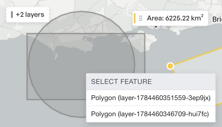
A badge in the corner of the map counts any additional layers under that point.
Select from the table instead#
Selection runs both ways. Click a row in the attribute table to select that feature and fly the map to it. Select a feature on the map, and the table highlights its row and scrolls to it. When you work through a list rather than a picture, drive from the table.
The other inspector cards#
The panel is context-sensitive, and its header tells you which form you look at. Select a measurement for the measurement card, an image overlay for its transform controls, and a text annotation for its own. See Measuring, Image overlays, and Annotations.
Press Escape on the map to clear the selection, or click the close button in the inspector header to put the panel away.